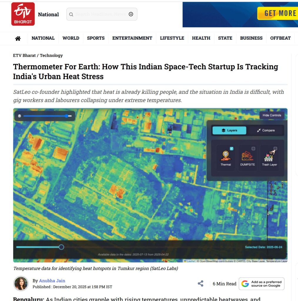
As Indian cities grapple with rising temperatures, unpredictable heatwaves, and mounting waste-related challenges, a quiet technological shift is underway. Space-tech startup SatLeo Labs is redefining how urban heat is tracked and tackled. By fusing satellite thermal data with drone-mounted infrared sensors, it is building a “thermometer for Earth”—mapping heat street by street, neighbourhood by neighbourhood, even plot by plot. As a senior journalist I held an in-depth conversation with Urmil Bakhai, co-founder of SatLeo Labs, discussing the model and its implications. Watch my video interview : https://www.youtube.com/watch?v=V5agxqxIJN8&t=6s
Read my detailed report: